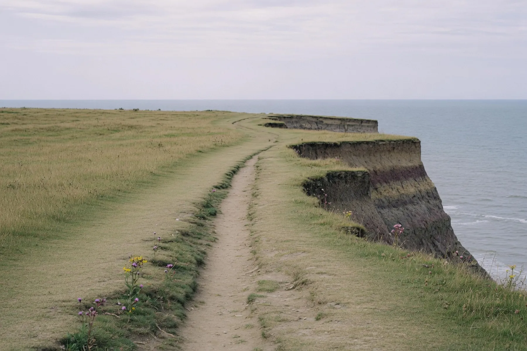
Scarborough sits on the coastal half of the Cleveland Way, not at either end of it. The National Trail runs 109 miles (176 km) from Helmsley to Filey, according to the North York Moors National Park. From this town you can walk the last day south to Filey Brigg, or a long day north to Ravenscar, and still be home if the buses and trains behave. Follow the acorn waymarks. Where a path has moved, the sign on the ground wins.
Through the town the Cleveland Way is a promenade walk, not a moorland one. It threads South Bay, the harbour and the castle headland, then North Bay as far as Scalby Mills. Pick it up by the Grand Hotel, at the Spa Bridge, on Marine Drive, or at the Sea Life end of the miniature railway. Surfaces here are tarmac and paving. The climbs start once you leave the sea walls.
South from the harbour you pass the Spa, the Italian Gardens and the South Cliff gardens — the same slope covered in the Spa guide. The Cleveland Way then leaves the resort and climbs onto the clay cliffs.
Visit Scarborough puts Cayton Bay three miles south of town. The National Trust looks after the wooded cliff and the sand. The descent to the beach is a steep concrete path with steps; Visit Scarborough flags that path as not suitable for wheelchairs. The clifftop trail itself is a different surface: grass, worn earth, and more steps as the path undulates. The Trust has taken woodland north of the Cleveland Way out of bounds after landslip — stay on the signed line. RNLI lifeguards cover the bay in the peak summer season. Any café on the sand is seasonal.
From Cayton the trail stays high past Lebberston and Gristhorpe toward Filey. The Ramblers measure a linear walk that follows the Cleveland Way for most of the way at 16.6 km / 10.3 miles from the Grand Hotel to Filey seafront, via Cayton and the Brigg. That is a full day if you stop. Filey itself is 10.8 km south of Scarborough centre as the crow flies, which is why the cliff walk feels longer than the road.
Filey Brigg is the point of the day. A National Trails easy-access walk starts at the small pay-and-display nearest the Brigg and follows a compacted limestone path to the obelisk that marks the end of the Cleveland Way and of the Yorkshire Wolds Way. Beyond the monument a grass path continues toward the rocky spit. Do not climb down the cliffs. The spit is a tide problem: check a tide table and the notices at the access points before you walk out on the rock. If the tide is in, the Ramblers use a higher path into town rather than the sand. Carr Naze, the landward end, is a Roman signal station, a Scheduled Monument on Historic England’s Heritage at Risk register because the cliff is eating it. Keep back from the edge.
This is the easy linear walk on this coast, because Filey has a railway.
Northern runs the Hull–Bridlington–Scarborough line through Filey (timetable N28, published 17 May to 12 December 2026). As of 12 September 2026 Northern was running an amended timetable after a Network Rail speed restriction between Seamer and Filey: trains still ran, journey times about ten minutes longer. Check the operator on the day you walk.
Buses are the backup. East Yorkshire Coaster 12, 12A and 12C run Scarborough–Filey–Bridlington. Coaster 13 adds the holiday-park loop via Cayton Bay and Blue Dolphin; North Yorkshire Council lists that 13 as seasonal, 28 March to 1 November 2026. After that date, do not assume a 13. Fares and last buses change — read the operator’s page.
North is a different walk. From the harbour the trail rounds Scarborough Castle on Marine Drive, then North Bay. Peasholm Park sits behind the sand. The North Bay Railway — twenty-inch gauge, about 1.4 km — runs from the park to Scalby Mills, where the promenade ends and the cliffs begin. SEA LIFE is at that far end. Ride out and walk back along the front if you only want the short version.
Once you cross Scalby Beck the Cleveland Way climbs onto the unfenced clifftop toward Crook Ness and Cloughton Wyke. The National Park puts Ravenscar nine miles from Scarborough on this trail. That is a long day if you also drop into Hayburn Wyke.
Visit North Yorkshire starts a published circular at Cloughton Station, four miles (6.4 km) northwest of Scarborough: five miles (8 km), about three hours, Cleveland Way out and the old railway back. Cloughton is the sensible short north day if Ravenscar feels too far.
Hayburn Wyke is the reason to keep going. A wooded valley drops to a boulder cove where Hayburn Beck falls onto the beach. The same Visit North Yorkshire sheet is blunt about the last bit: a steep descent and ascent, often on rough steps, muddy after rain. The clifftop above is mostly unfenced; keep a dog on a short lead. The National Trust bought the woods in 1981. There is a pub at the top. The beach is rock and tide, not a picnic lawn.
Ravenscar sits on a 600-foot headland, in the Park’s own words, looking across Robin Hood’s Bay. Victorian speculators laid out streets and drains in 1896 for a resort to rival Scarborough; almost nobody bought a plot. The hamlet is still called the town that never was.
The National Trust looks after the remains of Peak Alum Works — shale burned to make a dye fixative — and a Chain Home Low radar station of 1941, scheduled in 2002, in a field beside the trail. The last alum works on this coast closed in 1871.
Do not go down to the beach here. As of early September 2026 the Park’s Ravenscar page still carries a landslip notice: the path from the golf course to the shore is closed, and there is no way up for anyone walking the beach from Robin Hood’s Bay or Boggle Hole. The Trust says there is currently no beach access following cliff falls. Do not try to beat the tide around the foot of the cliff.
The Trust’s Yorkshire Coast page also states that the cafés at Ravenscar and at the Old Coastguard Station in Robin Hood’s Bay are now permanently closed. The visitor centre is reached by steps. Check the Trust before you count on a kettle. Public toilets sit about 200 metres from the centre.
Ravenscar is not on the railway, and the coast bus does not drop you at the hotel door.
East Yorkshire’s 9X is the bus that actually serves Ravenscar. Timetable data from the operator, dated 10 September 2026, showed two journeys each way on the days it ran, calling at Cloughton, Staintondale (Hayburn Beck Farm), Burniston and Scarborough station. The Park’s older page still names a service 5. Treat both as a prompt to check East Yorkshire before you walk, especially on a Sunday. Two buses a day is not a frequency you can miss.
Arriva X93 — with X94 in the summer season — runs Scarborough–Whitby along the A171, via Scalby, Burniston, Cloughton, the Flask Inn and Robin Hood’s Bay. It does not go into Ravenscar. Finish at Cloughton or Hayburn Wyke and you can use it; finish at Ravenscar and you catch the 9X or walk inland to the A171. The Trust is clear there is no direct Whitby–Ravenscar bus.
The old Scarborough–Whitby railway closed in 1965. Its trackbed is now the Cinder Track, 21 miles of walking and cycling line according to the Park. The Moor to Sea split puts Scarborough to Ravenscar at 10½ miles (16.9 km) — longer than the Cleveland Way’s nine miles, but without the cliff edge.
It is the way back if the wind on the clifftop has had enough of you, or the way out if you want a level surface. Cyclists and horses use it. The Park asks you to check its rights-of-way notices before you set off; temporary closures around Staintondale and Old Peak have been in force in 2026.
These are soft cliffs. They move. Follow the acorn that is in the ground today, not the line on an old map, and keep back from the edge. The Park’s notices page is the place to look the night before.
September is the walking month if you can pick it. The Jazz Festival fills the Spa on 25–27 September 2026 — confirm the programme with Scarborough Spa — but the clifftops stay quieter than the Foreshore. October is clearer still. After rain, Hayburn Wyke’s steps are the worst of it. A sea fret can sit on the cliffs while the moors inland are in sun: if you cannot see Filey Brigg from South Cliff, the long walk can wait.
For a shorter circuit, the walks around Scarborough page covers the two bays. Filey as a town rather than a trail end is in the day trips guide. Park before you start — the parking guide is the operational document — then walk one way and let a bus or a train do the other.